US Travel Guide 2025: Public Transport in Major Cities
US Travel Guide: Mastering Public Transportation in Major Cities in 2025 requires strategic planning. This guide helps navigate buses, subways, and trains in major US cities, ensuring efficient and budget-friendly travel.
Planning a trip to the US in 2025? Forget rental cars and expensive taxis! Mastering public transportation can unlock a new level of freedom and affordability. Our US Travel Guide: Mastering Public Transportation in Major Cities in 2025 will equip you with insider tips and essential knowledge to navigate like a local, saving you time and money.
Discover the best routes, apps, and hidden gems accessible by bus, subway, and train, making your urban exploration seamless and enjoyable.
US Travel Guide: Why Public Transportation Matters in 2025
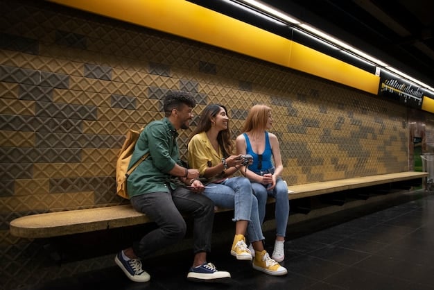
As we approach 2025, the importance of efficient and affordable public transportation in major US cities cannot be overstated. With increasing urbanization and a growing focus on sustainable travel, knowing how to navigate public transport systems is crucial for both tourists and residents.
Cost Savings and Convenience
One of the most compelling reasons to use public transportation is the significant cost savings compared to driving or ride-sharing. Parking fees, gas prices, and tolls can quickly add up, making public transport a much more budget-friendly option.
- Lower Travel Costs: Save money on gas, parking, and tolls.
- Avoid Traffic: Reduce stress and travel time by bypassing congested roads.
- Eco-Friendly: Contribute to a greener environment by reducing your carbon footprint.
- Convenient Access: Reach popular attractions and destinations easily.
Embracing Sustainable Travel
Choosing public transportation aligns with the global movement towards sustainable living and reducing environmental impact. By using buses, trains, and subways, you’re helping to decrease the number of cars on the road, thereby lowering carbon emissions and promoting cleaner air.
In conclusion, understanding and utilizing public transportation is essential for anyone traveling to or living in major US cities in 2025. The cost savings, convenience, and environmental benefits make it a smart choice for navigating urban landscapes.
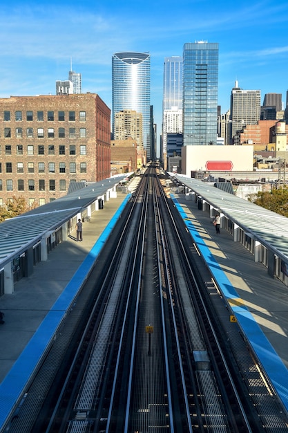
Navigating New York City’s Subway System in 2025
New York City’s subway system is one of the most extensive in the world, offering 24/7 service and connecting all five boroughs. However, its complexity can be daunting for first-time visitors. Mastering the NYC subway is a key aspect of any US Travel Guide: Mastering Public Transportation in Major Cities in 2025.
Essential Tips for Subway Travel
To make your subway experience smoother, consider these essential tips. First, purchase a MetroCard, which can be easily refilled at vending machines inside stations. Next, familiarize yourself with the different lines and their corresponding colors.
- Purchase a MetroCard: Available at vending machines inside stations.
- Download a Subway App: Citymapper or Google Maps can provide real-time updates.
- Plan Your Route: Identify the correct lines and directions before entering the station.
- Be Aware of Express and Local Trains: Express trains skip some stations, saving you time if you’re traveling longer distances.
Understanding Subway Etiquette
Subway etiquette is crucial for ensuring a pleasant experience for everyone. Always stand to the side to let passengers exit the train before you attempt to board. Avoid blocking doorways or taking up unnecessary space.
Effective navigation of New York City’s subway system requires preparation and an understanding of its intricacies. By following these tips, visitors can travel efficiently and confidently throughout the city.
Chicago’s ‘L’ Train: A 2025 Travel Essential
Chicago’s elevated train system, known as the ‘L’, is another vital component of any US Travel Guide: Mastering Public Transportation in Major Cities in 2025. This comprehensive network connects various neighborhoods and landmarks, making it an ideal mode of transportation for exploring the city.
Exploring Chicago via the ‘L’
The ‘L’ consists of eight color-coded lines, each serving different parts of the city. The Red Line runs north-south and is particularly useful for reaching attractions like Wrigleyville and Chinatown. The Blue Line connects downtown to O’Hare International Airport, making it a convenient option for travelers.
- Red Line: Connects north and south, ideal for reaching Wrigleyville and Chinatown.
- Blue Line: Provides direct access to O’Hare International Airport.
- Brown Line: Offers scenic views of the city’s architecture in the Loop.
- Use a Ventra Card: The Ventra card is Chicago’s version of a transit pass, available for purchase at vending machines.
Tips for Riding the ‘L’
To make the most of your ‘L’ experience, plan your routes in advance using online resources or mobile apps. Be aware of the different fare options and consider purchasing a day pass if you plan to travel extensively.
The ‘L’ train is not only a means of transportation but also an integral part of Chicago’s cultural identity. By utilizing this system effectively, visitors can explore the city’s diverse neighborhoods and attractions with ease.
San Francisco’s BART and Muni: Your 2025 Guide
San Francisco offers a combination of BART (Bay Area Rapid Transit) and Muni (Municipal Railway) to navigate the city and surrounding areas. These systems provide comprehensive coverage, making them essential for anyone following a US Travel Guide: Mastering Public Transportation in Major Cities in 2025.
Understanding BART and Muni
BART primarily connects San Francisco to cities in the East Bay and South Bay, such as Oakland and Berkeley. Muni includes buses, streetcars, and light rail lines within San Francisco itself. Understanding how these systems interact is crucial for efficient travel.
To navigate San Francisco effectively, it’s essential to understand the nuances of both BART and Muni. BART is ideal for traveling longer distances to surrounding cities, while Muni provides comprehensive coverage within San Francisco.
Tips for Using Public Transportation in San Francisco
To get around in San Francisco, it is helpful to use a Clipper card. To save some money, there is a CityPASS available.
- Purchase a Clipper Card: A reusable transit card accepted on both BART and Muni.
- Use Mobile Apps: Utilize apps like Citymapper for real-time updates and route planning.
- Consider a CityPASS: Offers discounted access to top attractions and transportation.
- Be Prepared for Hills: San Francisco is known for its steep hills; consider using buses or streetcars to avoid strenuous walks.
By familiarizing yourself with BART and Muni, you can easily explore San Francisco’s iconic landmarks, diverse neighborhoods, and vibrant culture. These systems offer a convenient and cost-effective way to experience everything the city has to offer.
Los Angeles Public Transportation: 2025 Updates
Los Angeles is known for its car culture, but in 2025, the city’s public transportation system is evolving. Metro Rail and bus networks offer viable alternatives for navigating LA, making it an increasingly important aspect of any US Travel Guide: Mastering Public Transportation in Major Cities in 2025.
Navigating LA Without a Car
Los Angeles County Metropolitan Transportation Authority (Metro) operates several rail lines and bus routes throughout the city and surrounding areas. The Expo Line connects downtown LA to Santa Monica, providing easy access to the beach. The Red Line runs through Hollywood and Universal City, making it convenient for tourists.
The expansion of LA Metro is transforming how people move around the city. The Expo Line, for example, offers a direct route from downtown to the beach in Santa Monica.
Tips for Using LA Metro
To navigate Los Angeles effectively, plan your trips ahead of time using online resources or mobile apps. Purchase a TAP card, which can be used on all Metro lines and buses. Be aware that service frequency may vary depending on the time of day and location.
- Purchase a TAP Card: A reloadable transit card used on all Metro services.
- Plan Your Route: Use online resources or mobile apps to determine the best routes and schedules.
- Consider Off-Peak Travel: Avoid crowds and potential delays by traveling during non-rush hours.
- Explore Park & Ride Options: Many Metro stations offer park & ride facilities, allowing you to combine driving and public transportation.
While Los Angeles may still be car-centric, its growing public transportation system offers a convenient and sustainable way to explore the city. By utilizing Metro Rail and bus networks, visitors can experience LA’s diverse attractions without the hassle of driving.
Future Trends in US Public Transportation (2025 and Beyond)
The future of public transportation in the US is rapidly evolving, with a focus on innovation and accessibility. As we look beyond 2025, several trends are shaping the way people move within cities, impacting the advice offered in any forward-thinking US Travel Guide: Mastering Public Transportation in Major Cities in 2025.
Technological Advancements
Technological advancements are playing a significant role in enhancing the efficiency and convenience of public transportation. Real-time tracking, mobile ticketing, and integrated payment systems are becoming increasingly common, making it easier for passengers to plan and pay for their trips.
Modern technology is transforming the transit experience. Real-time tracking allows passengers to monitor the arrival of trains and buses which significantly improves planning.
Emphasis on Sustainable Solutions
Sustainability is a key driver of innovation in public transportation. Electric buses, hybrid trains, and renewable energy sources are being adopted to reduce carbon emissions and promote environmental responsibility. These initiatives align with the growing demand for eco-friendly travel options.
- Electric Buses: Reducing emissions and promoting cleaner air in urban areas.
- Hybrid Trains: Improving fuel efficiency and lowering carbon footprint.
- Smart City Initiatives: Integrating public transportation with urban planning for greater efficiency.
- Increased Accessibility: Designing systems to accommodate passengers with disabilities and diverse needs.
Looking ahead, public transportation in the US is poised to become more efficient, sustainable, and accessible. These advancements will not only enhance the travel experience but also contribute to creating more livable and environmentally friendly cities.
| Key Point | Brief Description |
|---|---|
| 🚇 Subway Systems | Essential for navigating cities like NYC and Chicago. |
| 🎫 Transit Cards | Use MetroCard, Ventra, or Clipper for seamless travel. |
| 📱 Mobile Apps | Plan routes & track real-time updates with apps. |
| 🌎 Sustainability | Eco-friendly options reduce carbon emissions. |
Frequently Asked Questions
Utilize mobile apps like Citymapper or Google Maps for real-time updates and route planning. Purchase a transit card specific to the city you are visiting to save time and money.
Yes, Citymapper and Google Maps are popular choices. They provide real-time updates, route planning, and information on delays or service changes for major US cities.
Consider purchasing a day, week, or month pass if you plan on using public transportation frequently. This is often more cost-effective than buying single-ride tickets.
Check the transit authority’s website or app for updates. Look for alternative routes or bus services that can help you reach your destination. Allow extra time for your journey.
Public transportation is generally safe, but it’s wise to be aware of your surroundings. Keep valuables secure, avoid displaying expensive items, and be cautious in crowded areas, especially during peak hours.
Conclusion
Mastering public transportation is key to unlocking the full potential of urban exploration in the US. As this US Travel Guide: Mastering Public Transportation in Major Cities in 2025 has shown, with the right planning and knowledge, you can navigate major cities efficiently and affordably.
By embracing public transport, you’ll not only save money and reduce stress but also contribute to a more sustainable and enjoyable travel experience. So, plan your routes, download the essential apps, and get ready to explore!


